


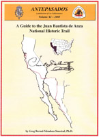
In keeping with his interest in education and public service, Sol Ideas founder Greg P. Smestad, Ph.D. has developed a trail guide for the Juan Bautista National Historic Trail. This project was carried out in conjunction with the National Park Service and Los Californianos.
Dr. Smestad received Federal Challenge Cost Share Program (CCSP) funds from the National Park Service to develop the innovative trail guide. The work was undertaken in collaboration with American Indians, musicians, historians and many other people. The project featured an audio component with sounds and songs relevant to the story of the trail. What was produced from the work is in the public domain and freely available to anyone.
Counties on the trail from south to north (PDF Links):
(Use the pulldown menu to select a county and then click “Go” to download the pdf file)
Go to the About the CD and Music page in the Anza Trail Guide to learn about the audio aspects of the project (Opens in a new window.).
The project included and acknowledged the contributions of the Native American and Hispanic communities that shaped the early development of California and Arizona. The Trail Guide combined maps, text and an audio CD so that it is useful for those who want to enjoy the trail while learning about it. The intent of the Trail Guide and CD was to provide portable interpretation of the trail that can be used in a variety of ways to raise awareness of how this trail affected the early Spanish colonization of the west. The Juan Bautista de Anza National Historic trail connects the past, present and future of North America.
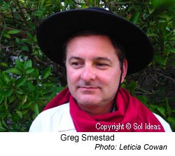
Greg is an eighth generation “Californio” descendant of several members of the 1775-76 Anza expedition (i.e. Apolinario Bernal, Luis Maria Peralta, Juan Salvio Pacheco, Ygnacio Soto and Barbara Espinosa, Maria Josepha Soto, and José Antonio Sanchez). His maternal line also contains several Native American ancestors.
In May 2017, the California Frontier Project interviewed Sol Ideas’ principal, Greg Bernal-Mendoza Smestad about Los Californios (the descendants of the de Anza Expedition). Read the blog post for Podcast Episode 002 “You Have to Carry This On”: What it Means to be a Californio with host Damian Bacich and guest Greg Bernal-Mendoza Smestad. Listen to just the interview:
Watch a video of a KTEH TV show, from the This is Us series, first presented on September 27, 2009, about the Juan Bautista de Anza National Historic Trail and Greg Smestad.
As part of his continuing interest in his Californio heritage, Greg was also involved in documenting and preserving the remarkable story of Juana Briones, whose mother came to California with the Anza expedition. Unfortunately, her house — one of the earliest in the area of Palo Alto, California — was torn down.
Related Links
- Anza Trail Guide Music and Music-related excerpts from the expedition diaries
- Video of Greg on the Anza Trail in This is Us, PBS station KTEH
- Web de Anza
- Bolton’s Anza’s California expeditions
- Mission 2000 database
- Early California Population Project
- Los Californianos Resources
Note: To read PDF files you will need the Adobe Acrobat reader, which can be downloaded free from the Adobe web site.