


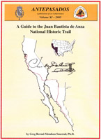
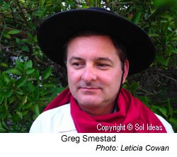
In keeping with his interest in education and public service, Sol Ideas founder Greg P. Smestad, Ph.D. has developed a trail guide for the Juan Bautista National Historic Trail. This project was carried out in conjunction with the National Park Service and Los Californianos.
Dr. Smestad received Federal Challenge Cost Share Program (CCSP) funds from the National Park Service to develop the innovative trail guide. The work was undertaken in collaboration with American Indians, musicians, historians and many other people. The project featured an audio component with sounds and songs relevant to the story of the trail. What was produced from the work is in the public domain and freely available to anyone.
Counties on the trail from south to north (PDF Links):
(Use the pulldown menu to select a county and then click “Go” to download the pdf file)
Music
Go to the About the CD and Music page in the Anza Trail Guide to learn about the audio aspects of the project (Opens in a new window.).
- Track 01 Introduction: Who Was Anza? Greg P. Smestad and Don Garate 6:54
- Track 02 The Alabado John Warren (Chant) Calicanto (Choral) Lance Beeson (Guitar) 3:46
- Track 03 Birth and Death: Salve de la Virgen de los Dolores, Salve Regina Lance Beeson (Guitar) John Warren (Choral) 2:19
- Track 04 O’odham Language and O’odham Sunrise David Shaul and John Ignacio (Words) Lance Beeson (Flute) 2:13
- Track 05 Casa Grande Song and Fandango (La Merlequina) Noel Milburn & Ron Kiel 2:23
- Track 06 Quechan Music at Yuma: Quechan Memorial Song Jack Wilding's Mules & Ron Kiel 2:22
- Track 07 Desert Fandangos: Cattle Drive, Chacona, El Minuet de Cuatro Lance Beeson (Guitar) 4:38
- Track 08 Santa Catarina Springs, Fandango and Nativity: La Xameico, La Posada Ron Kiel & Calicanto 4:24
- Track 09 The Morning Hymn: El Cantico del Alba and The Alabado Lance Beeson 2:17
- Track 10 The Chumash, the Channel and the Sea Michael Phillips 3:43
- Track 11 Carpenter Birds and Font’s Te Deum Woodpeckers & John Warren 3:20
- Track 12 The Mutsun Quirina Luna-Costillas 1:28
- Track 13 Henry Coe State Park Berry Breckling 4:09
- Track 14 Bear of San Mateo and Flintlock Rifle Gunfire Los Soldados de Santa Barbara 0:17
- Track 15 San Francisco: Marcha Real, Ah, Susanita Calicanto (Instrumental and Choral) 6:31
- Track 16 The Bay Miwok Catherine A. Callaghan 1:19
- Track 17 To Alta California Don Garate (Ballad) 3:52
The project included and acknowledged the contributions of the Native American and Hispanic communities that shaped the early development of California and Arizona. The Trail Guide combined maps, text and an audio CD so that it is useful for those who want to enjoy the trail while learning about it. The intent of the Trail Guide and CD was to provide portable interpretation of the trail that can be used in a variety of ways to raise awareness of how this trail affected the early Spanish colonization of the west. The Juan Bautista de Anza National Historic Trail is a fun way way to enjoy the outdoors while learning about the history, and perhaps the present and future, of the lands that it passed though.
Background: The Setting of the Anza Expeditions
The world of the 18th Century was in many ways very different than ours. Anza’s task was given to him by the Viceroy of New Spain, who administered this part of the New World for King Carlos III of Spain. At the time, European empires were clashing for dominance and control of the lands that, to them, were new. Carlos III knew that there were not enough people in Spain to settle these lands to hold them, so he adopted a strategy utilized by the Roman Empire called Colonization by Conversion. Using it, the native peoples were encouraged, and often forced, to convert to the religion (Catholicism) and cultural and economic ways of the Spanish. This strategy had worked in Nueva España since the conquest of the Aztec Empire, between 1519 and 1521, primarily led by Hernán Cortés.
But Juan Bautista de Anza lived 250 years later; the year was 1775. The Laws of the Indies (Spanish: Leyes de las Indias) had been developed to govern the development of the Spanish colonies and the treatment of its peoples. Under these laws, Anza was under strict orders to treat the natives he met along the trail with respect and kindness. He gave a warning (Anza’s diary, Sunday, October 29, 1775) near the beginning of the 1775-76 expedition to the expedition’s families and emphasized the importance of maintaining peaceful relations with the Indigenous peoples they encountered. The diaries of the Anza expedition document this and the contact with each of the tribal peoples that they met.
Anza completed his tasks and then returned to the Presidio of Tubac; he was granted the governorship of New Mexico (negotiating a peace treaty with the Comanche). One can find an introduction to the events following the Anza Expedition by looking on pg. 95 found by downloading the whole Anza Trail Guide in PDF (65.7 MB). You can also download the back end of the trail guide here. Related Links are provided below for those who want to delve further and learn more. The Anza trail provides a physical path to consider the long history of California and the west. The Juan Bautista de Anza National Historic Trail therefore connects the people and places of past, present and future of North America.
As part of a historic collaborative partnership, five years in the making, the American Indian Alaska Native Tourism Association (AIANTA) and the National Park Service Juan Bautista de Anza National Historic Trail Program, with support from the Arizona Office of Tourism and Visit California, launched The Travel Guide to Tribes Along the Juan Bautista de Anza National Historic Trail. That travel guide is separate from, but complementary to, the Juan Bautista de Anza Trail Guide and Audio CD Project accessed on this website. Use the About the CD and Music here to learn more about why certain sounds and songs were chosen. Each chapter of the trail guide (accessed above as PDFs) also has an, “On the CD” section. You can also listen online to the, “Sounds of Nature and Culture” along the Anza trail organized in a convenient format.
About the Author:
Greg is an eighth generation “Californio” descendant of several members of the 1775-76 Anza expedition (i.e. Apolinario Bernal, Luis Maria Peralta, Juan Salvio Pacheco, Ygnacio Soto and Barbara Espinosa, Maria Josepha Soto, and José Antonio Sanchez). His maternal line also contains several Native American ancestors.
In May 2017, the California Frontier Project interviewed Sol Ideas’ principal, Greg Bernal-Mendoza Smestad about Los Californios (which includes many of the descendants of the de Anza Expedition). Read the blog post or listen to just the interview for Podcast Episode 002 “You Have to Carry This On”: What it Means to be a Californio with host Damian Bacich and guest Greg Bernal-Mendoza Smestad. Listen to just the interview:
Watch a video of a KTEH TV show, from the This is Us series, first presented on September 27, 2009, about the Juan Bautista de Anza National Historic Trail and Greg Smestad.
As part of his continuing interest in his Californio heritage, Greg was also involved in documenting and preserving the remarkable story of Juana Briones (PDF opens in a new window), whose mother came to California with the Anza expedition. Unfortunately, her house — one of the earliest in the area of Palo Alto, California — was torn down. An article on her can be read here.
Related Links
- The Anza Trail and 21st Century Social Justice (blog post)
- Anza and the Settling of California (book)
- With Anza to California (book)
- Juan Bautista de Anza: Son of the Frontier (audio)
- The Anza Trail, This is Us, PBS station KTEH (video)
- Web de Anza (diaries online)
- Diaries of the Anza Expedition (book)
- County Trail Guides from Anza.org
People
- Expedition Roster
- Mission 2000 database
- Early California Population Project
- Los Californianos Resources
Anza Blog
We’ve provided some insights on Anza and the Anza trail in a blog format for your perusal. Click here to access it.
Note: To read PDF files you will need the Adobe Acrobat reader, which can be downloaded free from the Adobe web site.