Map Showing Campsites 47, 48 and 49
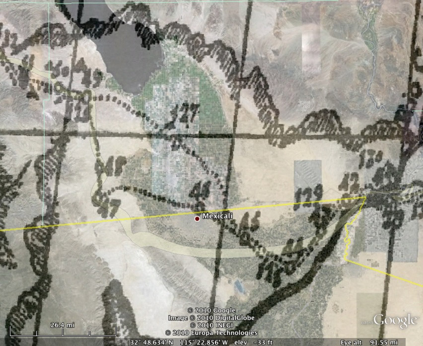
Father
Pedro Font's map of the Anza
expedition of 1775-1776 showing campsites 47 [Yuha Wells],
48 [north of Plaster City] and 49 [San Sebastian Indian Village].
This map is rectified at campsites 41, 47, 49 and superimposed
on a Google
Earth map for direct comparison.
To download jpg image: right-click (or Ctrl-click
on a Mac) on image above and select "Save Picture As" or "Save
image as" to save the image on your computer. Note that the
downloaded file will be larger than the image displayed above.
|